
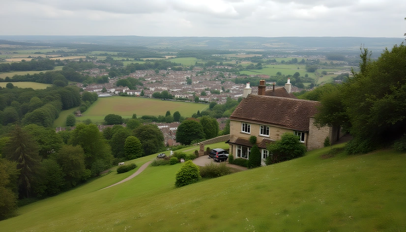
persia country map
Resize and add details
Convert to video
Outpaint the rest of the image
Additional Info
ModelFlux
Seed1487646862
More Ai art like persia country map


Design a north-facing double storey modern farmhouse suitable for steel frame and brick construction in a warm climate. Ground floor: – Open-plan kitchen, dining, and living area flowing toward the north-facing veranda – Kitchen with central island – Large scullery and separate laundry located directly off the kitchen, with generous storage and external service access – Small guest bedroom / study downstairs with access to a bathroom (can double as a guest suite) – Guest WC or shared bathroom downstairs – Central staircase with good natural light First floor: – 3 bedrooms, all en-suite – Main bedroom larger, with en-suite and wardrobe space – A small TV lounge / pyjama lounge upstairs, positioned near the bedrooms Outdoor living: – Large covered veranda on the north side for winter sun and summer shade – An enclosed sunroom / snug on the east side of the veranda, positioned to catch prevailing breezes and morning light – Strong indoor–outdoor connection from the main living space Design & style: – Modern farmhouse / country farmhouse aesthetic – Simple rectangular footprint, efficient structural grid – Pitched roof with generous overhangs – Optimised for cross-ventilation and passive solar design Provide ground and first floor plans with room labels and approximate dimensions.
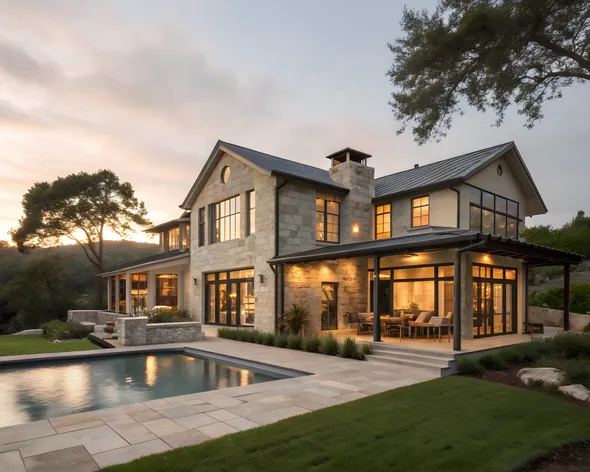
Create a 2D architectural plan for a two-story country house, with a maximum of 300 m² of construction, in a modern, soft industrial style. The ground floor should include: a 35 m² double-height living room overlooking the pool, a 15 m² integrated dining room, a large open-plan kitchen with an island (20-25 m²), a medium-sized pantry (5-6 m²), a 40-45 m² master bedroom with exterior views, a spacious bathroom and a large dressing room, a 12-15 m² gym, a guest bathroom, an 8-10 m² laundry area with a cupboard, a three-car garage with a 6-8 m² storage room, a 25-30 m² barbecue area, and a 3 x 5 meter swimming pool located in front of the living room. It should include a metal staircase with floating wooden treads in an industrial style (without visible supports). The upper floor should include three additional bedrooms: two 12 m² bedrooms with built-in wardrobes and a shared bathroom, and one 12 m² bedroom with a small en-suite bathroom (4 m²). It should also include an open-plan living room or study of 12 to 15 m² with views of the double-height ceiling. All bedrooms should have views of the surrounding countryside or the swimming pool. The layout should be functional and realistic, considering a country house on a 1000 m² plot.
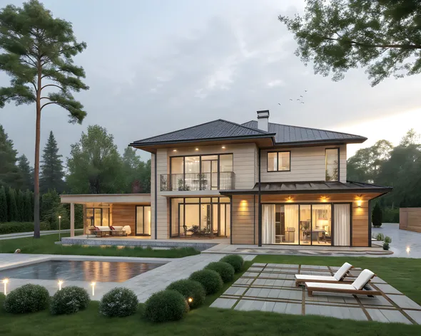
Create a 2D architectural plan for a two-story country house, with a maximum of 300 m² of construction, in a modern, soft industrial style. The ground floor should include: a 35 m² double-height living room overlooking the pool, a 15 m² integrated dining room, a large open-plan kitchen with an island (20-25 m²), a medium-sized pantry (5-6 m²), a 40-45 m² master bedroom with exterior views, a spacious bathroom and a large dressing room, a 12-15 m² gym, a guest bathroom, an 8-10 m² laundry area with a cupboard, a three-car garage with a 6-8 m² storage room, a 25-30 m² barbecue area, and a 3 x 5 meter swimming pool located in front of the living room. It should include a metal staircase with floating wooden treads in an industrial style (without visible supports). The upper floor should include three additional bedrooms: two 12 m² bedrooms with built-in wardrobes and a shared bathroom, and one 12 m² bedroom with a small en-suite bathroom (4 m²). It should also include an open-plan living room or study of 12 to 15 m² with views of the double-height ceiling. All bedrooms should have views of the surrounding countryside or the swimming pool. The layout should be functional and realistic, considering a country house on a 1000 m² plot.


